About Us Honeymoons or Couples Honeymoons or Couples
Family Holiday Packages 
Executive Luxury Safaris
Kenya Travel Guide
Kenya Holiday Reviews 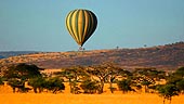
Hot Air Balloon Safaris
ATOL Financial Protection
|
AMBOSELI NATIONAL PARK |
 |
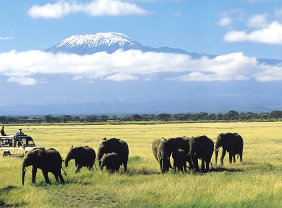 |
Amboseli lies immediately North West of Mt. Kilimanjaro, on the border with Tanzania. Amboseli was established as a reserve in 1968 and gazetted as a National Park in 1974. The Park covers 392 km2, and forms part of the much larger 3,000 Km2 Amboseli ecosystem. Large concentrations of wildlife occur here in the dry season, making Amboseli a popular tourist destination.
It is surrounded by 6 communally owned group ranches. The National Park embodies 5 main wildlife habitats (open plains, acacia woodland, rocky thorn bush country, swamps and marshland) and covers part of a pleistocene lake basin, now dry. Within this basin is a temporary lake, Lake Amboseli, that floods during years of heavy rainfall. Amboseli is famous for its big game and its great scenic beauty - the landscape is dominated by MT Kilimanjaro.
Its located on the border with Tanzania, Kajiado District, South Kenya, and Covers 392km2. The climate is mainly hot and dry. Amboseli is in the rain shadow of Mt. Kilimanjaro.
The maximum average temperature of the warmest month is 33°C during the day, while that of the coldest is 27-28°C. An annual rainfall of 300mm per annum is distributed in two seasons: April/May and November/December. Recurrent droughts and potential evaporation of 2200mm per annum typifies the region (KWS, 1991).
The national park embodies several types of semi-arid vegetation and swampland/marshland. In general there is a gradient of vegetation from the bare lake bed, through grassland to Acacia woodland following a North -North West to South - South East pattern sandwiching the permanent swamps.
Water flowing underground from Mt. Kilimanjaro upwells in a series of lush swamps and marshland which support sedges of Cyprus spp., including Cyprus papyrus and that provide dry season water and forage for wildlife. These swamps are flanked by tracts of acacia woodland with yellow-barked acacia, Acacia xanthophloea and Acacia tortilis. Acacia tortilis also occurs in the southern part of the park along on drainage lines.
The basin is surrounded by acacia/commiphora bushland while the level floor of open plains with saline/alkaline soils supports thickets of Salvadora persica and Suaeda monoica. Grasses include needlegrass Aristida, fingergrass Digitaria, dropseed Sporobolus sp., stargrass Cynodon dactylon, and Phragmites mauritianus. Balanites aegyptiaca is important as a source of edible fruits, while the pods of Acacia tortilis are eaten by livestock.
There has been a tremendous loss of woody vegetation that has been attributed to various factors including the rise of water table, increase in salinity, off road driving by tour vehicles and destruction of vegetation by elephants.
|
MADUKHA TOURS UK Suite 12 Friary Chambers,
Whitefriargate,
Hull High Street,
East Yorkshire,
HU1 2HA
Tel: 0845 257 7005 | Fax: 0148 221 3881 | Enquiry Form |